This is some text inside of a div block.
arrow_back
Spatial Cloud
arrow_forward

What is the Spatial Cloud?

Every decision about the physical world depends on spatial data, and that data exists, but it is scattered across hundreds of providers and impossible to use without specialized tools. The Spatial Cloud is the infrastructure that changes this: one place where spatial data from any provider is governed, connected, and queryable by anyone, from any tool, in seconds.

Why It Matters

Why does every decision have a "where"?

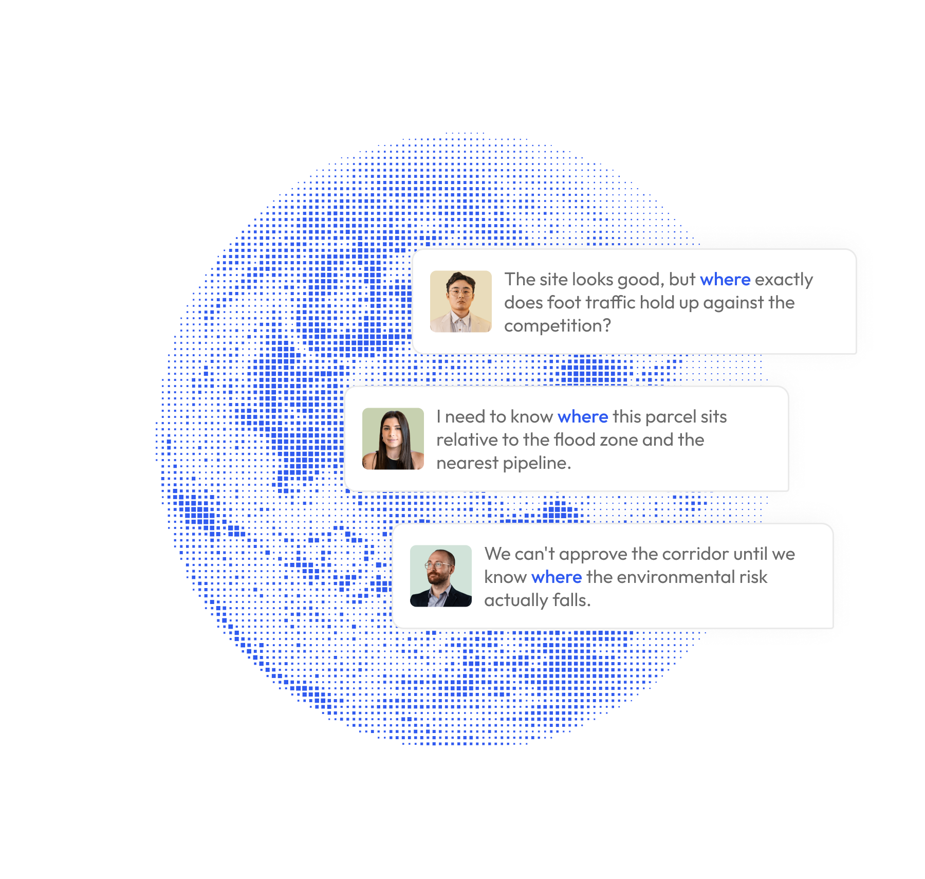
A retailer picking the next store location needs foot traffic, demographics, lease risk, and competitive density for a specific address. An insurance adjuster validating a claim needs weather events, pipeline proximity, and flood zones for a specific parcel. A city planner routing infrastructure needs land use, environmental risk, and population density for a specific corridor.

The Problem

What happens when spatial data is scattered?

view_comfy_alt
Fragmented data.
Parcels in one system, demographics in another, risk in a third. By the time you have the full picture, the decision has moved.
person_play
Specialist bottleneck.
Most spatial questions go unasked because the answer takes three weeks.
psychology_alt
AI without ground.
Ask any AI about a real place. The answer is built on training data, not current governed spatial data.
paid
Data that earns once.
Sell a file, the buyer disappears. In a world where AI agents make billions of micro-requests, that model breaks.
The Answer

One infrastructure. Every dataset.

The Spatial Cloud is the infrastructure layer that makes spatial data from any provider governed, connected, and queryable by anyone, from any tool, in seconds.

Providers bring data. It is governed at runtime and made available through four surfaces. Buyers combine purchased data with their own on the same grid. AI users ask questions and get real answers. The data stays governed. The answers arrive in seconds.

The Products

Four ways to work with spatial data.

01
Ask your AI.
BigGeo AI puts spatial answers inside the AI conversation you are already having. Ask ChatGPT or Claude a question about any location. Get a governed, accurate answer in sub-second time. No new app. No GIS skills.
02
See it on a map.
DataScape is a persistent, collaborative canvas where your team visualizes spatial data together. Layers, filters, annotations, and saved views. The work stays where you left it. AI agents can create DataScapes too.
03
Build with it.
DataLab is the workspace where every dataset you own lives on a single grid. Combine purchased data with your own uploads. Author Variants that define what each team can see, do, and share. No code required.
04
Buy and sell it.
The Marketplace is where governed spatial datasets from trusted providers are discovered, purchased, and activated. Buy the slice you need: one metro, one state, one zoom level. The data is live in your workspace the second you buy it.
The Model

One dataset. Many products. No copies.

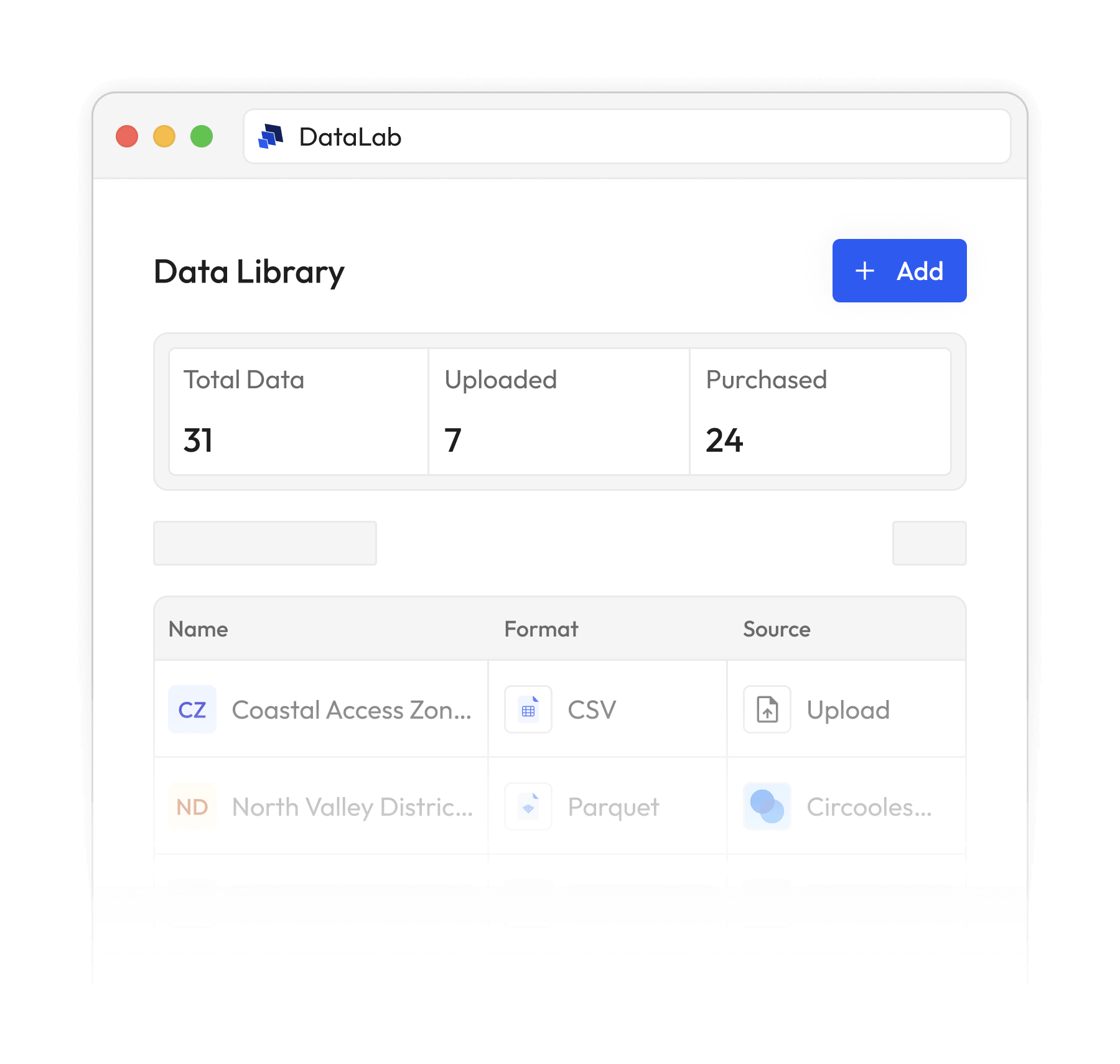
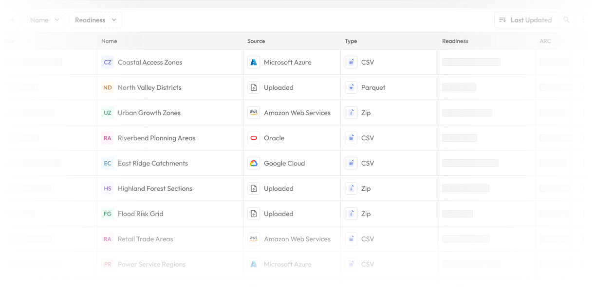
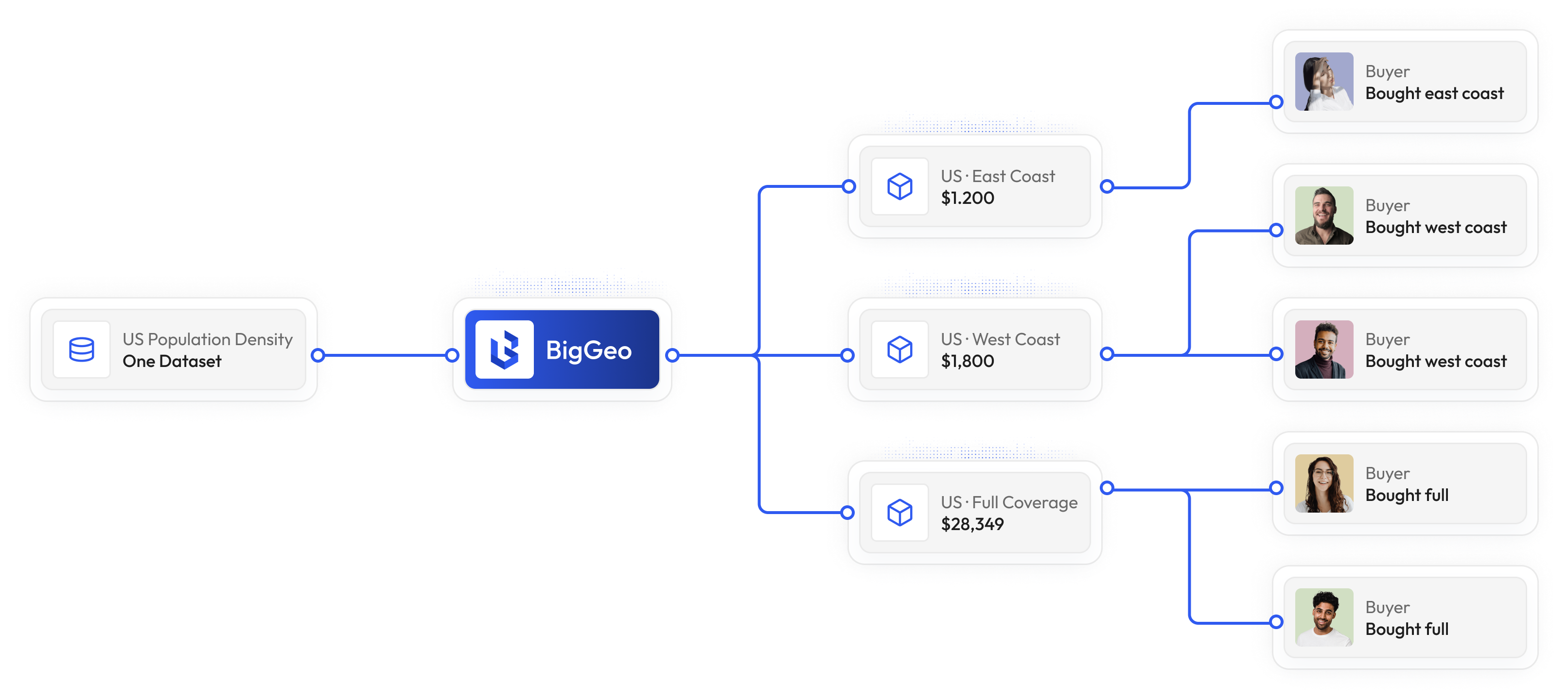
On the Spatial Cloud, a dataset becomes a product through something called a Variant. A Variant defines who can access the data, what they can do with it, where it can go, and how they pay. One dataset can have many Variants: a national subscription for one buyer, a metro per-query feed for another, AI-only access for a third. The data is never copied. The policy is. For buyers, purchased data is immediately combinable and queryable. For providers, your data earns across every surface without leaving your control.

How does the Spatial Cloud deliver governed answers in sub-second time?

shield
Vault
Governance runtime.

On every request, at runtime, it decides who can access spatial data, what they can do with it, and from where. The controls travel with the data wherever it flows.

done
Enforced at runtime
arrow_forward
done
Access control per request
arrow_forward
done
Policy travels with data
arrow_forward
bolt
Velocity
Spatial compute engine.

It prunes the search space at planning time and executes against only the data the query touches. Sub-second response holds under real load.

done
Sub-second response
arrow_forward
done
Query-scoped execution
arrow_forward
done
Scales under load
arrow_forward
done
No full scans
arrow_forward
database
Strata
Spatial data layer.

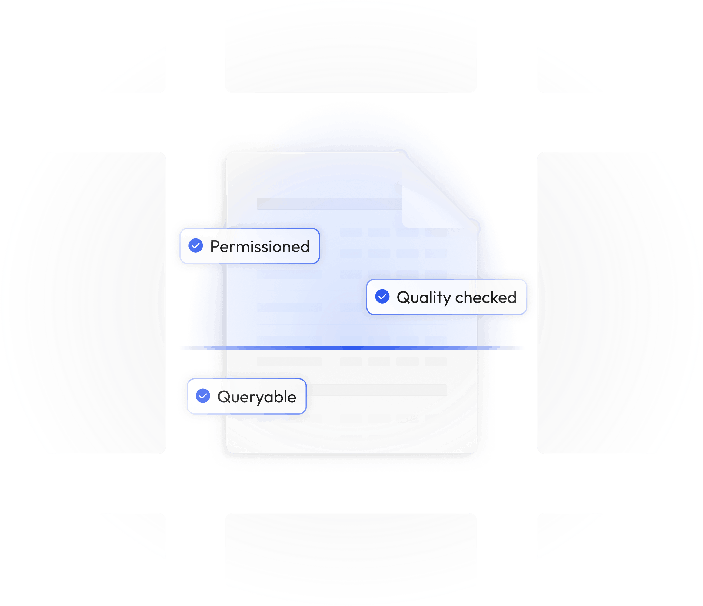
Every dataset is structured, indexed, and computation-ready the moment it arrives. Four resource tiers, from distributed cloud to sovereign single-server, with the same data and same architecture.

done
Indexed on ingest
arrow_forward
done
Four deployment tiers
arrow_forward
done
Same data, any environment
arrow_forward
done
Sovereign-ready
arrow_forward
Who It Is For

Who uses the Spatial Cloud?

01
Teams that need spatial answers.
Retailers picking store locations. Insurers validating claims. Logistics companies routing fleets. Government agencies planning infrastructure. Researchers studying environmental risk. Any team that asks "where" and needs a real answer, fast and governed, without a specialist in the middle.
02
Data providers that want their data to earn.
Mobility companies, parcel data providers, demographic data firms, environmental data collectors. Any organization that owns spatial data and wants to distribute it across new channels, including AI agents, without losing control of the asset. One dataset, many products, perpetual revenue.
03
Anyone using AI to ask about the real world.
Open ChatGPT or Claude. Ask about any location. Through BigGeo AI, the answer is grounded in governed spatial data instead of training-data guesses. No new app. No new account. The AI you already use just got smarter about where things are.
FAQ

Frequently asked questions

What is the Spatial Cloud?
add
How is this different from a GIS platform?
add
How is this different from a data marketplace?
add
What kind of spatial data is available?
add
Do I need GIS skills?
add
Trust and Governance

Canadian-owned. Governed by design.

BigGeo is headquartered in Calgary, Canada. Canadian-owned infrastructure. Canadian jurisdiction. Governance is not a feature you turn on. It is the runtime itself. Every query evaluated on three axes: who is asking, what they are doing, from where. Unauthorized data is unreachable, not just unreadable.