
Ask any location question. Get a real answer. That is it.
BigGeo's Cell Towers dataset gives network planners and GIS teams instant spatial access to 100,000 tower records indexed against population density, terrain, and regulatory layers. Stop spending weeks on site analysis that still produces the wrong answer.
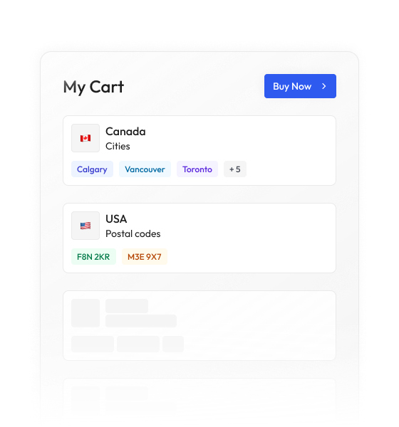
Most data vendors sell you a national license to millions of records you will never contact. BigGeo works differently. You tell us where you sell, and we cut you exactly that geographic slice of the dataset. A single city.
A cluster of ZIP codes. A metro area. A county. Whatever matches your territory. The result is a lean, CRM-ready file containing only the companies in the markets you actually work, delivered at a fraction of the cost of a full national license.
Network planners are making multi-million dollar tower deployment decisions using fragmented data pulled from disconnected systems, stitched together in spreadsheets, and validated by GIS analysts who are already three projects behind. The result is coverage gaps that persist for quarters and capital allocated to sites that fail permitting. This is not a workflow problem. It is a data access problem.
Every tower record is spatially indexed so you can immediately identify where existing infrastructure sits relative to your candidate sites. That means coverage overlap analysis runs in seconds, not days.
Overlay tower locations against population density and mobility signals to surface underserved areas with precision. You stop guessing where demand exists and start ranking sites by actual coverage improvement potential.
Combine tower data with terrain, land use, and zoning layers inside BigGeo DataLab to rank every candidate site by construction feasibility and permitting risk before a single dollar enters the capital plan.
With 100,000 records indexed and combinable across spatial layers, your planning team can run multi-market coverage scenarios simultaneously. Portfolio-level tower strategy no longer requires weeks of analyst time.
BigGeo AI is live in ChatGPT and Claude today, giving your network planning and GIS teams the ability to ask complex spatial questions about tower coverage, population demand, and site feasibility in plain language and get accurate, governed answers grounded in real indexed data. The analysis that used to require a GIS specialist, a data pull, and a 48-hour turnaround now takes the time it takes to type a question. The underlying tower data never leaves the governed compute path, regardless of how the question is asked.